Gyeokjabong, a mountain with the heritage of Yoon Sun-do
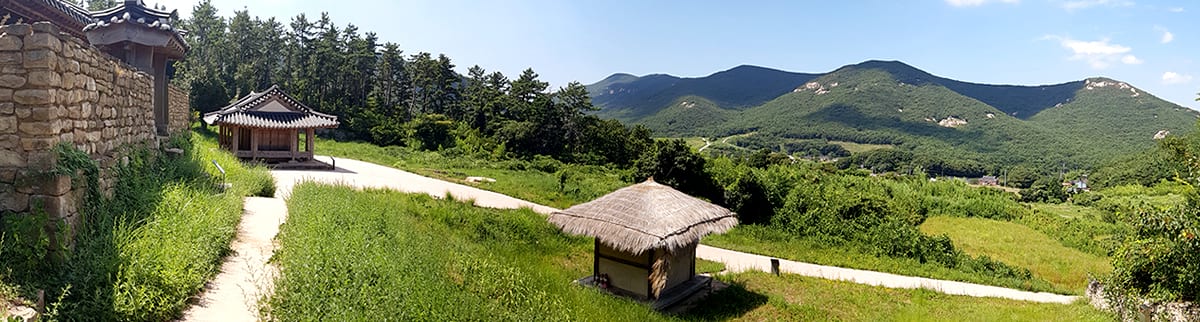
Bogildo itself is a large natural park. With 15 annexed islands within 12km to East and West and 8km to North and South, this island is remaining hidden in archipelago marine national park. At the center is Jeokjabong (425m). Jeokjabong was named after the mountain itself made of evergreen trees that reflect the sunlight in red color when the sunlight shines. Around Jeokjabong are Gwangdaebong (311m) and Mangwolbong (350m) in a circle and inside is Buyongdong that was resided by Yoon Sun-do.
Travel Course

- Course 1 : Jeongjari old house → Nameunsa → Bboraegijae → Gyeokjabong summit → Keungiljae → Dongsan
- Course 2 : Seyeonjeong → Bogil Elementary School → Buyongri office → Goksudang → Nakseojae → Sansindanggol → Gyeokjabong summit
Other Course
Yesongri → Keungiljae → Suribong → Jeokjabong → 425bong → Bboraegijae → Mangwolbong → Seonchangri
Start from the back of Yesongri village with the most beautiful beach in Korea. This route has thick forest like the trail from Nakseojae. Climb up for 30 minutes looking at trees and you'll reach Keungiljae. Although the ridge of Mangwolbong is short, with rocks here and there, you can go to Mangwolbong looking at the sea to the left and right. Standing up on Mangwolbong, you can see beautiful archipelago.


Bookri → Bboraegijae → 425bong → Nuruk Rock → Summit → Suribong → Keungiljae → Nakseojae
This trail recently started to gain popularity among hikers. This trail, starting from the opposite of Buyongdong reaches Bookri along beautiful coastal road to climb up Bojuksan and then hiking will start when you reach the valley at the back of village. Bojuksan Mountain is the official name used by National Geography Institute, but villagers still call it Bbyojoksan Mountain. With low summit, it has steep slope that connects to the summit via wooden tunnel. When you catch your sweaty breath, the freshness of summit will welcome you.
After hiking the Bojuksan Mountain, when you reach the path via the center road to the village, the trail toward Bookrijae will begin. While climbing, you will see large Neoreok Rock that will sit 50 people, Bookri village and Chujado Island. Climb up 10 minutes more to reach Bboraegijae, and then via 425bong, Jeokjabong, Suribong and Keungiljae, you will step down to Nakseojae.
Nakseojae → Sansindanggol → Keungiljae → Summit → 425bong → Bboraegijae → Seonchangrijae → Nameunsa → Gureongmokgol → Nakseojae
This trail is laid around Jeokjabong. First, Nakseojae, the residential area in Buyongdong is the starting point of this hiking course. Nakseojae was resideed by Gosan but today, only the stone walls and house site are remaining. Next to Nakseojae is Goksudang, and the small stream next to Goksudang is Chananggol. This is where the hiking begins.
Mountain road up to Keungiljae along Chananggol is tunneled by thick forest that is dark even during the day. Climb up for 20 minutes to get to Keungiljae summit. Continue on from here to get to Yesongri or climb up to the left to reach Gwangdaebong. With the Gwangdaebong to the back, head toward the right to get to the ridge of Suribong. Walk for 50 minutes to climb up to Suribong and see Bogildo in a glance to all sides. The southern beach is particularly beautiful. Groups of boxwood trees and Korean hornbeam trees are growing.
This is where the most outstanding view from ridge of Jeokjabong is offered. The view from the summit of Nuruk Rock at 10m height is splendid. At the foot, Buyongdong is unraveled named by Gosan after the shape of lotus flowers blossoming. This is genuine beauty.